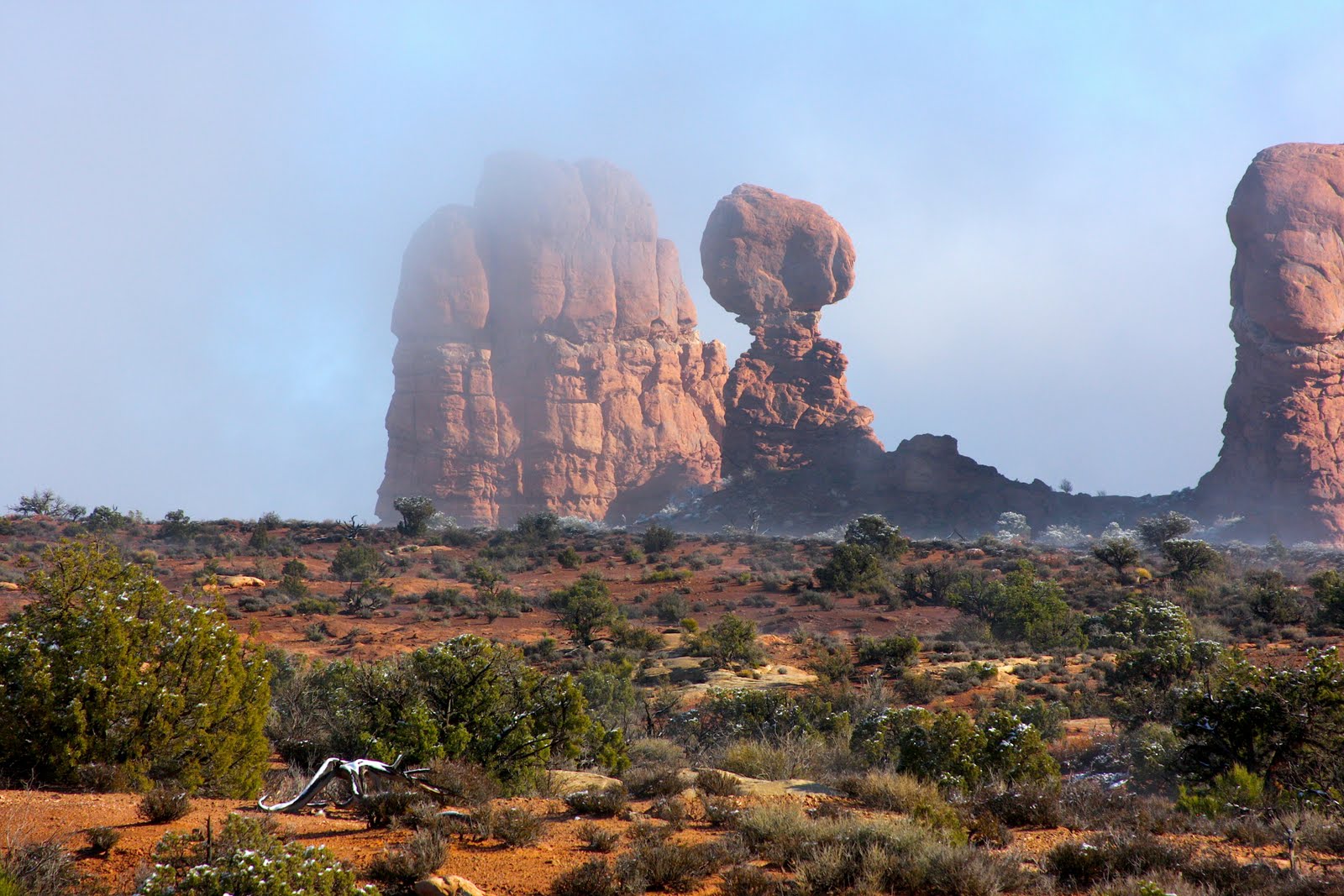
After the second day of hiking the Fiery Furnace, my knees were beyond recovery, so I forfeited the hikes, bike rides, and strenuous activities offered by the less broken-down baby boomers on this trip. Terry had gone on the dome trip the day before, eleven miles of steep downhill and uphill hiking, his calves were killing him. He opted to come with me on a photo expedition into Arches National Park. I lucked out because he’s a geologist so I learned a bunch about the structure of the layers of sandstone, shale, and the underlying salt dome that is the primary reason for the collapse of the Salt Valley. To summerize, a thick layer of salt got laid down about 300 million years ago, and as uplift and erosion finally etched away the layers of rock above, water was able to seep down and melt the salt away, leaving a huge dome shaped cavern that eventually caved in. The rocks that fell down line the valley, and water has since taken away much of the jumble to expose the rock below.
We went to the Windows area and hiked around a bit there and giggled at a Japanese couple we kept running across; the man took dozens of pictures, every one was of his wife posed in front of this arch, that arch, or some nice rock formation. She posed in exactly the same way, near as I could tell. He could have just photo-shopped her image into each one of the arch photos and saved himself (and her) a lot of trouble. I noted that she’d changed from her high heels to a pair of Keds for the trek around the backside of the windows.
Then we decided to take our gear and hike over to Delicate Arch. We read up on the trail and were informed we would see chert rocks. Turns out there were huge boulders of chert! Some had rolled down from above and scattered shattered bits of chert everywhere. At the bottom of a dry stream bed of brown rocks a lone cottonwood in full golden regalia grew out of a sparkling chert diamond floor. It was magical.
 |
| Early morning fog in Arches Nat'l Park |
The walk out was nice, the sun low and warming, mostly downhill. One little chipmunk raced all over, which surprised us. It was exceptionally exposed on the red rock and ought to be easy pickings for a hawk.
 |
| La Sal Mountains |
On Saturday, Terry felt like going back to the Dome area with Irene’s daughter, a geologist, who was guiding that family on the 11 mile trip. I would have enjoyed hearing her talk, but my knees weren’t up to such a steep and long hike. So on Saturday I was joined by Dennis who had injured his shoulder bike riding. I guess I was the go-to-gal for the gimps of the trip. Dennis and I went to a spot outside the park where some petroglyphs are hidden amongst the rocks. Had it not been for his guidance I never would have known they were there, and they were quite unusual. The sign said that area was a cross-roads for several different groups so some of the glyphs were Ute, Anasazi, and even some Navajo, though how an amateur could tell the difference I don’t know. We then drove to the end of the paved road in the park and hiked into Devil’s Garden. The arch I thought had fallen, the Landscape Arch, was not the one that crashed in 2008, it was one nearby. Signs were posted at its location, with photos of how it used to look. Ropes and signs keep people out of that area as the rocks haven’t finished the entire descent just yet.
 |
| Fins of Sandstone, Finland!! |
Beyond that spot the trail led up the edge of a fin. It was not a trail I’d ever taken due to timidity back in 2003 when I was last here. I can’t say I wasn’t initially terrified, but I had a bit more confidence and braved it. Actually the fin wasn’t the worst of that trail, steeper and scarier rocks would be up ahead, but none of it was as bad as the cliff we’d gone down on Wednesday. It was a fine hike through many fins, over ledges, the trail marked with worn rock and cairns. It ended at a double arch, with a large rounded portal above a smaller one. We saw people coming and going, but the trail was not crowded. A much longer trail leads down into “Finland” an area with row after row of tall slim rocks. Off in the distance the land stretches out until it was hard to tell whether the blueish haze was land or sky. While it took most of the afternoon to reach the double arches and return to the car, the distance was only about 4 miles round trip. The last of four days in Moab, one of the finest places on earth.
No comments:
Post a Comment